
A drone pavement assessment uses GPS-mapped aerial imagery, ground observations, and pavement zoning to document the condition of parking lots, roadways, and other paved surfaces on a commercial property. It helps owners and portfolio managers prioritize repairs, estimate capital costs, and plan maintenance before minor cracking and drainage issues turn into costly pavement failures.
Parking lots, private roadways, loading areas, and other paved surfaces represent a significant investment for commercial property owners. Without consistent evaluation and preventive maintenance, minor cracking, drainage concerns, and surface deterioration can develop into expensive pavement failures.
HC Inspectors provides professional commercial pavement condition assessments supported by high-resolution drone imagery, aerial mapping, field observations, and commercial property inspection experience. Our assessments help owners, facility managers, investors, property managers, and portfolio operators understand existing pavement conditions and develop practical plans for maintenance, repair, rehabilitation, and future replacement.
Some property owners refer to this service as a pavement inspection, a parking lot inspection, or a parking lot condition assessment. Whatever the terminology, the goal remains the same: an independent, documented evaluation of pavement conditions that property owners can use to make informed decisions.
For commercial properties in Columbus, Central Ohio, and surrounding markets, our drone-supported approach combines aerial documentation with ground-level observations to identify pavement deterioration, organize assessment zones, and prioritize maintenance needs. The resulting information supports repair planning, remaining pavement service life estimates, and capital expenditure (CapEx) budgeting, helping property owners make practical, cost-conscious decisions.
Our team provides independent observations and recommendations. We do not sell paving or resurfacing services, allowing our clients to receive objective information without contractor upselling or a financial interest in the recommended repairs.
HC Inspectors provides a full range of drone-supported pavement management services for commercial properties, including:
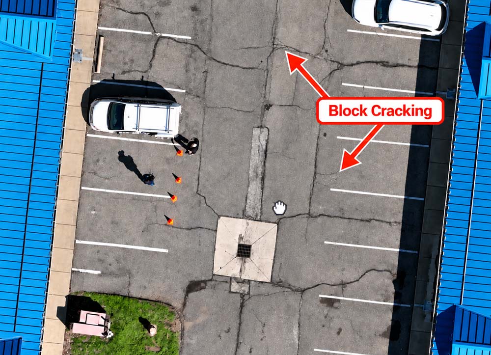
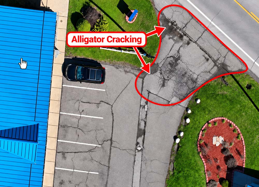
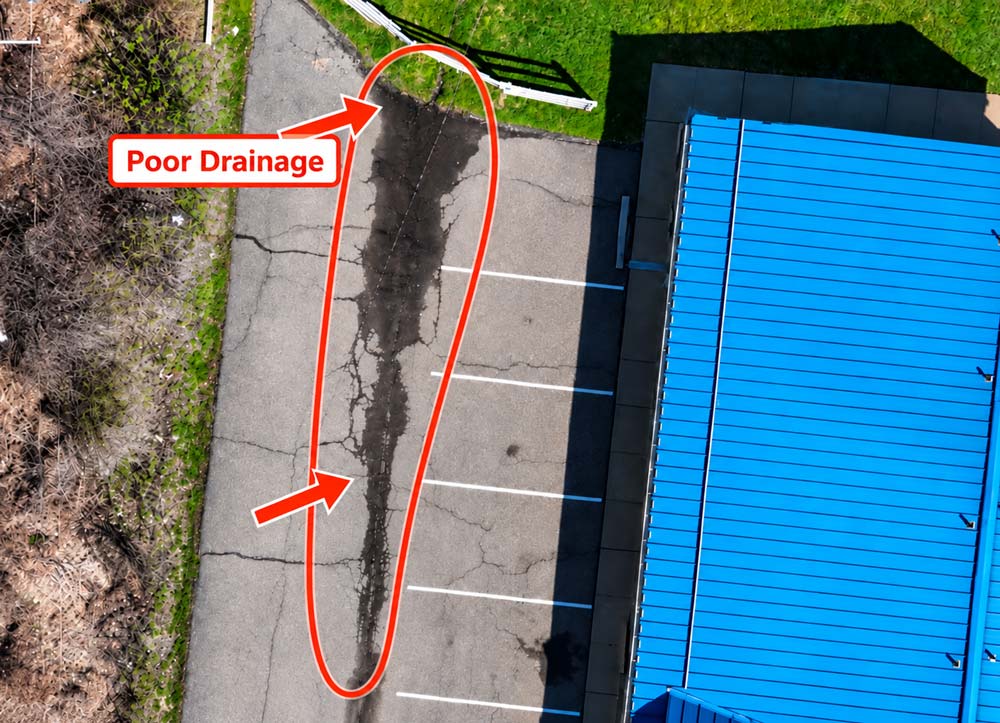
An effective pavement-management program is more than identifying damaged asphalt. It involves evaluating current conditions, dividing the property into manageable pavement zones, documenting visible distress, establishing repair priorities, and estimating future capital needs.
Before beginning the assessment, we work with the client to establish project-specific criteria based on the property type, pavement age, ownership or lease requirements, maintenance history, anticipated use, and available capital budget.
Our pavement assessments may be performed as a standalone service or incorporated into a broader Commercial Property Condition Assessment.
Every property and portfolio is different. We begin by identifying the client’s objectives and developing an assessment scope, then move through each step below.
We identify the client’s objectives and develop an assessment scope based on factors such as:
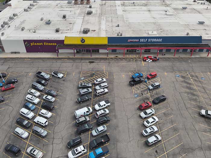
Our FAA Part 107 Certified Drone Pilots use commercial drone technology to capture high-resolution aerial imagery of parking lots, access drives, loading areas, private roadways, and other paved surfaces.
Drone imagery allows large pavement areas to be documented efficiently while providing a clear visual record of the property’s overall condition. Depending on the project scope, the collected imagery may be used to create aerial maps, annotated site plans, orthomosaic images, and 2D or 3D site models.
Captured imagery is GPS-referenced, so specific pavement conditions, zones, and repair locations can be mapped accurately and revisited consistently over time.
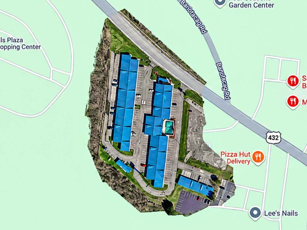
Large parking lots are divided into individual pavement zones based on use, construction type, traffic patterns, condition, drainage, or repair history. This allows each section to be assessed according to its specific pavement conditions and maintenance needs.
Separating pavement into zones helps clients identify where deterioration is occurring without treating an entire parking field as one uniform surface. Areas with different traffic levels, drainage conditions, or previous repairs can be documented and compared independently.
Each zone can then be mapped, prioritized, budgeted, and monitored over time, helping property owners plan immediate repairs, preventive maintenance, and future replacement.
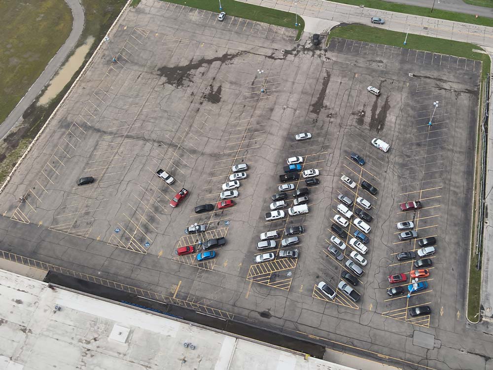
Our team evaluates visible pavement conditions and documents common forms of asphalt and concrete deterioration, including:
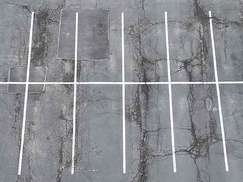
Where included in the agreed scope, we also record approximate pavement measurements and quantities for each zone to support repair-cost estimating, and pavement areas may be organized and rated using Pavement Condition Index principles or another client-specific condition-rating system.
As part of the pavement assessment, our team can document visible, accessible-parking-related observations, including the general condition and presence of accessible parking spaces, access aisles, curb ramps, and posted signage. General accessible-parking requirements are outlined in the U.S. Department of Justice’s ADA accessible parking guidance.
The Pavement Condition Index (PCI) is a numerical rating system used to describe pavement surface condition based on the type, severity, and extent of visible distress. PCI ratings range from 0 to 100, with higher scores indicating better pavement conditions. ASTM D6433-24 outlines the standard practice for roads and parking lots PCI surveys.
A PCI-based evaluation can help establish a consistent condition rating for individual pavement zones and assist with comparing multiple properties within a portfolio. The resulting information can be used to identify areas that may benefit from preventive maintenance, localized repairs, rehabilitation, or replacement.
Drone imagery improves the efficiency and consistency of pavement documentation. However, a defensible PCI rating still requires a structured distress-measurement process and qualified evaluation. Aerial photography alone does not establish an ASTM-compliant PCI score.
Poor
Fair
Satisfactory
Good / Excellent
The assessment does not determine subsurface pavement construction or structural capacity unless additional testing is specifically included. Core sampling, laboratory testing, geotechnical investigation, ground-penetrating radar, or engineering analysis may be recommended when surface conditions indicate possible underlying failures.
Not every pavement defect requires immediate replacement. In many cases, timely maintenance can slow deterioration and extend the useful life of the pavement.
Based on observed conditions, we can help classify pavement needs into practical planning categories, such as:
Recommendations are prioritized based on condition, safety, operational impact, potential for continued deterioration, and anticipated cost.
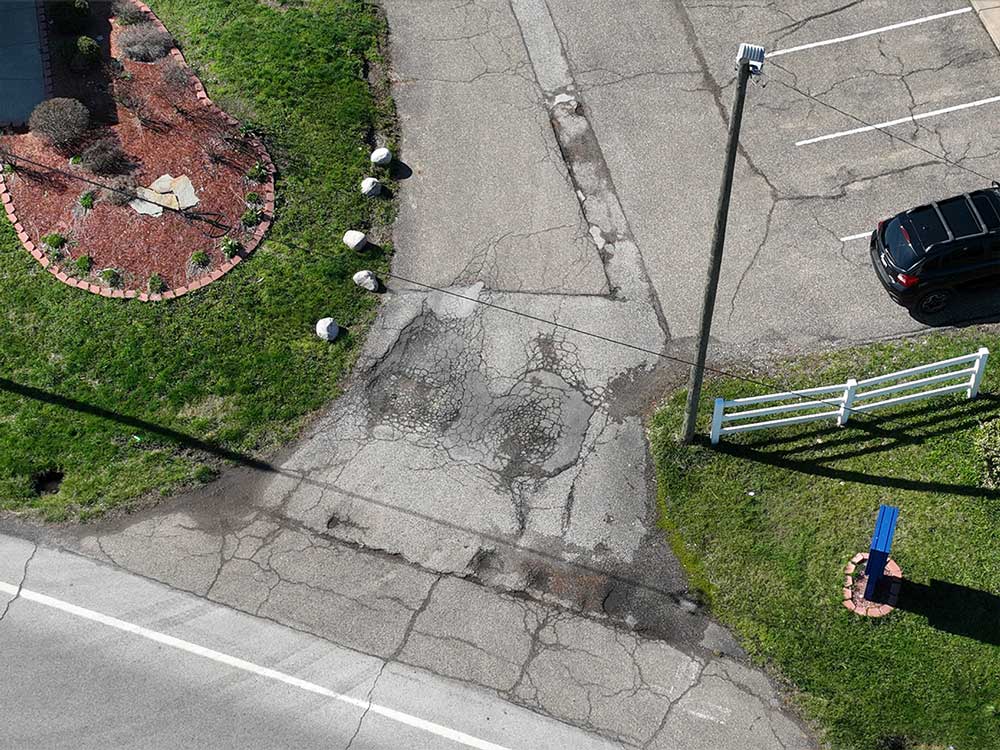
Get a clear, independent picture of current conditions before planning next year’s repair budget.
Our pavement-management assessments help clients move from reactive repairs to planned asset management.
Depending on the project scope, deliverables may include conceptual repair quantities, opinions of probable cost, anticipated replacement periods, remaining useful life estimates for major pavement areas, and short- and long-term capital-planning recommendations.
This information can support:
Opinions of probable cost are provided for planning purposes and should be confirmed through competitive contractor bids before construction.
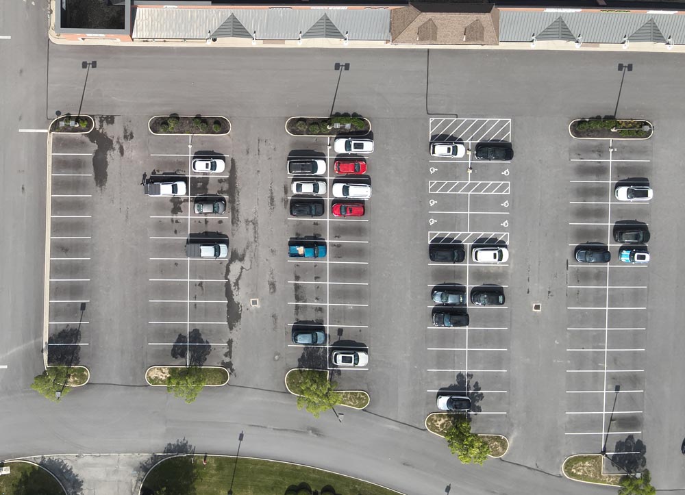
Our involvement doesn’t have to end with the initial assessment. When requested, we can stay engaged through the entire pavement project, from the original condition assessment through contractor selection and final completion documentation.
Clear documentation helps property owners obtain more consistent and comparable contractor proposals. When requested, we can develop a preliminary scope of work identifying pavement zones, observed conditions, recommended repair types, approximate quantities, and project priorities.
Additional construction-phase services may include:
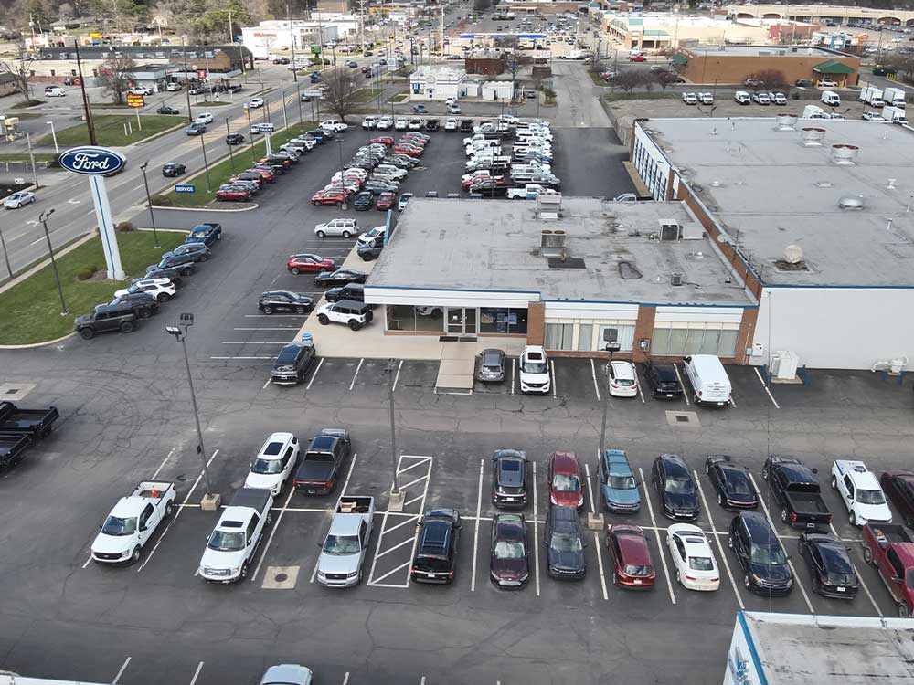
HC Inspectors provides scalable pavement-management services for clients responsible for multiple commercial properties.
Using consistent inspection criteria, reporting formats, pavement-zone classifications, and repair priorities, we help clients compare conditions across an entire portfolio. This provides decision-makers with a clearer understanding of which properties require immediate attention and which locations can be managed through routine preventive maintenance.
Portfolio pavement assessments are well suited for:
Retail shopping centers
Industrial facilities
Office complexes
Healthcare properties
Automotive facilities
Religious facilities
Apartment & multifamily communities
Warehouses & distribution centers
Schools & institutional facilities
Hotels & hospitality properties
Commercial property portfolios

Drone technology allows large parking fields and private roadway systems to be documented more efficiently than ground-level photography alone.

Detailed aerial imagery provides a clear record of pavement conditions and helps clients understand the location and extent of observed deterioration.

Mapped pavement zones and annotated aerial images help owners communicate repair priorities with contractors, asset managers, lenders, and other project stakeholders.

Standardized assessment criteria allow multiple properties to be evaluated and compared using a consistent process.

Because we do not sell paving installation or repair services, our recommendations are based on observed property conditions rather than the sale of construction work.

Condition classifications, repair priorities, and conceptual cost estimates help clients plan expenditures before minor deterioration develops into extensive pavement failure.
HC Inspectors combines commercial property assessment experience with advanced drone and thermal-imaging capabilities.

We provide pavement evaluations as part of a practical, property-focused approach to asset management, due diligence, maintenance planning, and capital forecasting. Since 2012, our company has completed more than 13,000 combined properties, and environmental inspections. Our available capabilities include:
A drone pavement assessment uses high-resolution aerial imagery, ground-level observations, and pavement zoning to document the condition of parking lots, roadways, and other paved surfaces on a commercial property, so owners can plan maintenance, repairs, and capital spending based on actual site data.
Largely, yes. Property owners use different terms, pavement assessment, pavement inspection, parking lot inspection, for the same underlying service: a documented, independent evaluation of pavement condition used to guide maintenance, repair, and capital planning decisions.
A PCI rating is based on the type, severity, and extent of visible surface distress observed across a pavement zone. Drone imagery can improve how efficiently and consistently that documentation is captured, but a defensible PCI rating still depends on a structured measurement process and evaluation by a qualified pavement professional.
No. Drone imagery documents pavement conditions more efficiently and provides a clear visual record, but a certified PCI rating requires an established distress-measurement methodology and qualified evaluation, not aerial photography alone.
The assessment documents common forms of asphalt and concrete deterioration, including alligator and fatigue cracking, potholes, raveling, rutting, depressions, failed patches, standing water, drainage-related concerns, and damaged curbs or pavement markings, among other visible conditions.
Yes. Our team can document visible, accessible-parking-related conditions such as accessible space striping, access aisles, curb ramps, and posted signage. These are informational observations, not a legal ADA compliance survey or certification.
No. The company provides independent observations and recommendations and does not sell paving or resurfacing services, so clients receive objective information without contractor upselling or a financial interest in the recommended repairs.
Large parking lots and roadway systems are divided into individual pavement zones based on use, construction type, traffic patterns, condition, drainage, and repair history, so each zone can be evaluated, prioritized, and budgeted independently rather than treating an entire parking field as one uniform surface.
Depending on the project scope, deliverables can include annotated aerial maps, orthomosaic imagery, pavement-zone condition ratings, repair-priority classifications, conceptual repair quantities and measurements, remaining useful life estimates, and opinions of probable cost for planning purposes.
Yes. Home & Commercial Inspections provides scalable, multi-site pavement-management assessments using consistent inspection criteria and reporting formats, which allows owners and portfolio managers to compare pavement conditions across an entire portfolio.
Yes. Home & Commercial Inspections provides drone-supported pavement and parking lot assessments for commercial properties throughout Ohio, in addition to multi-site portfolios located outside the state.
The right interval depends on pavement age, traffic volume, prior repair history, and the property’s capital-planning cycle. A structured, recurring assessment schedule helps owners catch minor deterioration before it develops into a more costly pavement failure.
A properly planned pavement-management program can help extend pavement service life, reduce unnecessary replacement, improve property safety, and make future expenditures more predictable. Whether you manage one commercial property in Central Ohio, elsewhere in Ohio, or a multi-state portfolio, HC Inspectors can develop a customized pavement-assessment program based on your properties, objectives, and capital-planning requirements.